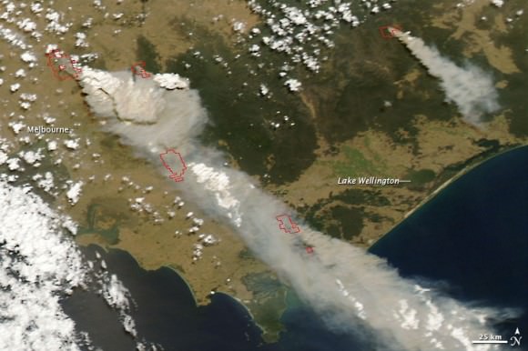
Here's a Satellite view from Saturday 7th Feb.

This Satellite image only shows the fires in the south. There are more fires in Northern Victoria.
Here's a link to an updated map.
http://maps.live.com/default.aspx?v=...=en-us&style=h
This is very depressing to watch unfold. Bush fires are just part of life in Australia. We are used to seeing them every year and families and communities have fire plans and preparations for fire. The CFA (Country Fire Authority) often have burn offs to limit the amount of fuel available and create breaks. Farmers mow a strip around their paddocks to stop a grass fire from spreading if it starts. Many people with country properties have tanks and pumps and even roof mounted sprinklers
Yet despite all the preparations is sad to see that the fire can get the better of us. It shows us just how intense the firestorm is. Well prepared people are still caught by it trying to escape or defend their properties.
The closest fire to me is about 30 Miles but we are upwind so fairly safe.